
No products in the cart.
| State | Uttarakhand |
| Location | Dehradun |
| Duration | 8N/9D |
| Valid Age | 18 – 60 |
| Support Contact | 01145999000 |
| Reporting Point | Reporting at Dehradun (Prince Chowk) and departure for Lohajung at 6:00 a.m. |
Hidden high in the Garhwal Himalayas, Roopkund Lake lies at approximately 16,500 feet (5,029 metres) in Chamoli district of Uttarakhand.
Known popularly as “Skeleton Lake”, Roopkund became famous because hundreds of human skeletal remains have been discovered around the lake and beneath its waters.
The mystery surrounding the lake has fascinated explorers, historians, scientists and trekkers for decades.
The skeletal remains were brought to wider official attention in 1942, when forest ranger Hari Kishan Madhwal encountered human remains around the frozen lake.
For many years, it was popularly believed that the skeletons belonged to a group of pilgrims who perished in a catastrophic hailstorm.
According to local folklore, Raja Jasdhaval, his pregnant wife Rani Balampa and their entourage were travelling towards the Nanda Devi shrine when they were caught in a devastating hailstorm.
However, modern scientific research has made the mystery even more fascinating.
Studies of the skeletal remains have established that they did not all belong to people who died at the same time. DNA and radiocarbon analysis indicate that the remains represent people from different populations and different periods, including individuals with South Asian ancestry and a group with eastern Mediterranean ancestry.
The exact reason why these people came to Roopkund and how they died remains unresolved.
And that is the mystery you trek into.
A frozen lake at 16,500 feet.
Ancient skeletons.
A forgotten story.
And the mighty Himalayas all around.
Participants proceed for their onward journey as per their individual travel arrangements.
The trek passes through several distinct Himalayan ecological zones.
Lower Himalayan Forests
Around Lohajung and Didna, participants encounter forests containing:
Oak, Rhododendron, Deodar, Spruce, Fir and other Himalayan species.
Alpine Meadows
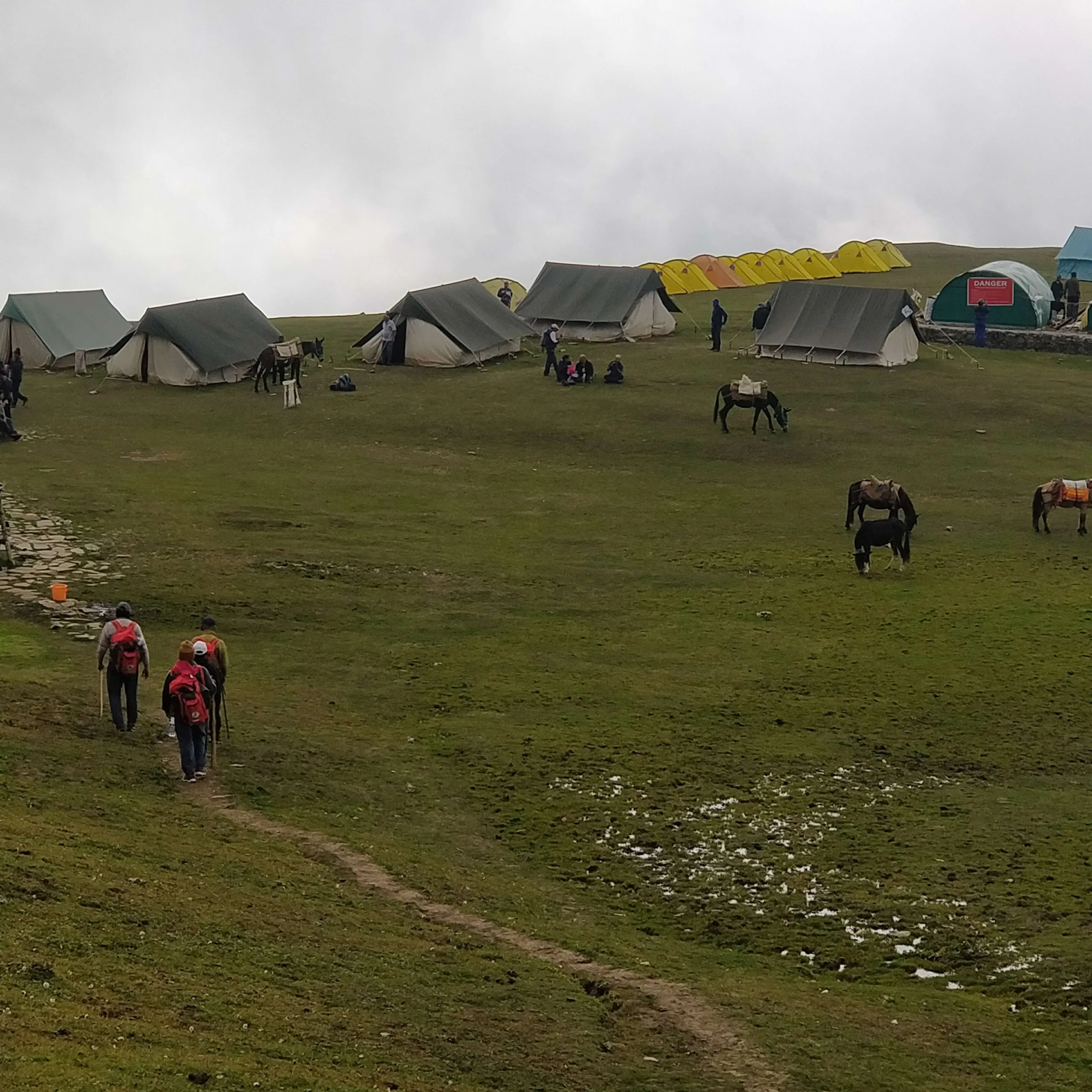
As the trail climbs above the forest line, the landscape opens into magnificent high-altitude meadows known as Bugyals. The Bedni Bugyal region is particularly spectacular and is traditionally used as a high-altitude grazing ground.
High-Altitude Flora
The region is home to numerous alpine flowers and herbs, including:
Brahma Kamal, Anemone, Gentian, Primula, Pedicularis, and other alpine Himalayan species.
The wider Himalayan landscape around the Roopkund region supports a rich variety of wildlife. Possible species include: Himalayan Musk Deer, Bharal / Blue Sheep, Himalayan Tahr, Himalayan Serow, Himalayan Black Bear, Himalayan Snow Leopard.
Birdlife includes species such as: Himalayan Monal, Koklass Pheasant, Himalayan Snowcock, Himalayan Griffon.
Participants should undertake appropriate physical preparation before joining the programme.
The trek is suitable only for physically fit participants capable of undertaking a difficult high-altitude trek.
A Medical Fitness Certificate not more than 7 days old must be produced as required by YHAI.
Participants must disclose relevant medical information to the organisers/medical team.
By Train
Dehradun Railway Station is the nearest railway station to the reporting point at Prince Chowk.
Dehradun is well connected by rail with Delhi and other major cities of India.
Participants travelling from Delhi can conveniently reach Dehradun by train, including overnight services.
By Bus
Dehradun is well connected by road with Delhi and other major cities.
Regular bus services, including government and private buses, are available to Dehradun from major cities.
By Air
Jolly Grant Airport, Dehradun is the nearest airport.
The airport is approximately 25–30 km from Dehradun city and is well connected with major Indian cities.
Distance: Approximately 317 km
Travel Time: Approximately 10 hours
The scenic mountain route generally passes through:
Dehradun → Karnaprayag → Tharali → Dewal → Lohajung
The journey time may vary depending upon weather, traffic and mountain road conditions.
YHAI will arrange the group transportation from Dehradun to Lohajung, with the transportation cost payable separately by participants.
Depending upon availability, equipment such as: trekking shoes, backpack, sleeping bag, trekking jacket, and other essential trekking equipment may be available on rental.
Special Casual Leave is applicable
Special Casual Leave is applicable for participation in this YHAI program subject to the applicable rules of the participant’s organisation/institution.
| Distance | 317 km |
| Travel Time | Approximately 10 hours |
| Altitude | 7,700 ft |
Reporting at Dehradun (Prince Chowk) and departure for Lohajung at 6:00 a.m.
The scenic mountain road takes you through the Kumaon and Garhwal Himalayas, passing through picturesque hill towns and valleys.
Terrain: Mountain road journey; no trekking.
Overnight: Lohajung Base Camp
Important: YHAI will arrange transportation from Dehradun (Prince Chowk) to Lohajung, but the transportation charges will be payable separately by participants and are not included in the ₹17,500 program fee.
| Trekking | Few kilometres with altitude gain |
| Altitude | 7,700 ft |
A relaxed day dedicated to acclimatization and preparation. The day will include:
Trek orientation and briefing, introduction to high-altitude trekking, equipment and packing check, safety briefing, short acclimatization walk.
Roopkund involves considerable altitude gain over a short period. Proper acclimatization helps the body adjust gradually to decreasing oxygen levels.
Overnight: Lohajung
| Vehicle | Lohajung to Kulling |
| Trek Distance | 8 km |
| Duration | Approximately 5 hours |
| Altitude | 8,500 ft |
After breakfast, the group travels by vehicle from Lohajung to Kulling, from where the trek begins.
The trail enters the forested Himalayan landscape and gradually climbs towards Didna Village.
Didna is a traditional mountain settlement and offers an opportunity to experience Himalayan village life and local hospitality.
Terrain: Forest trail with gradual and moderate ascent.
Difficulty: Moderate
Ascent: Approximately 800 ft overall from Lohajung altitude, although the actual trekking elevation gain.
Overnight: Didna Village Homestay
| Distance | 10 km |
| Duration | Approximately 7 hours |
| Altitude | 11,300 ft |
Today the trek becomes more demanding.
The trail gradually climbs away from Didna and moves deeper into the Himalayan wilderness. Forest gradually gives way to open meadows as altitude increases.
Terrain: Forest trails, mountain slopes, meadows and alpine terrain.
Ascent: Moderate to steep, with approximately 2,800 ft of altitude gain.
Difficulty: Moderate to Difficult
Overnight: Abin Kharak / Khobal Tal Camp
| Distance | 7 km |
| Duration | Approximately 4 hours |
| Altitude | 12,800 ft |
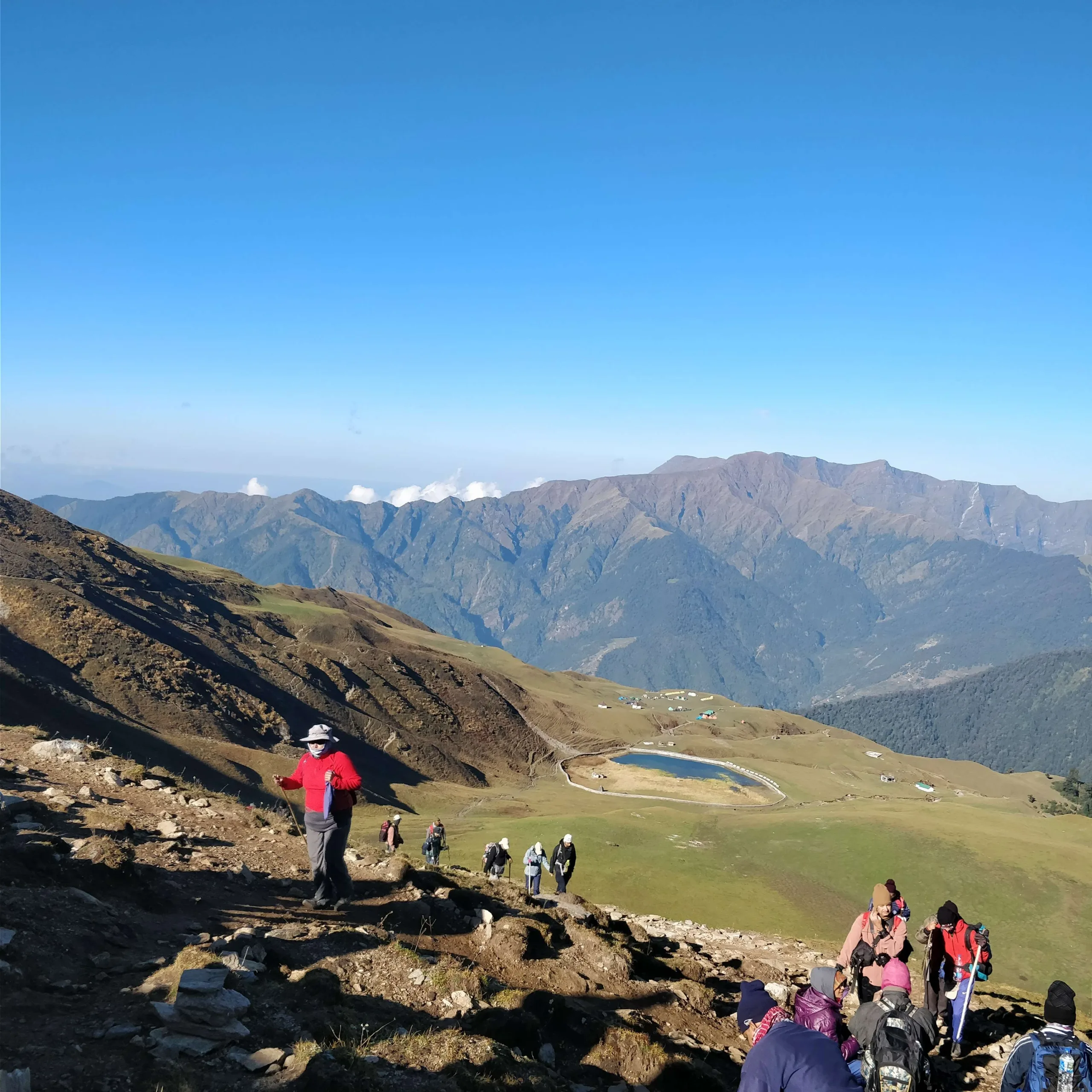
The trail climbs towards the spectacular Bedni Bugyal, one of the most beautiful high-altitude meadows of Uttarakhand.
On a clear day, the surrounding Himalayan panorama opens dramatically, with magnificent views towards Trishul and Nanda Ghunti.
The trail then continues towards Pathar Nachauni, where the landscape becomes increasingly rocky and exposed.
Terrain: Alpine meadow → rocky high-altitude trail.
Ascent: Moderate to steep
Altitude Gain: Approximately 1,500 ft
Although the distance is only 7 km, the increasing altitude makes this a demanding day.
Overnight: Pathar Nachauni Camp
| Distance | 5 km |
| Duration | Approximately 4 hours |
| Altitude | 14,200 ft |
The high-altitude journey begins
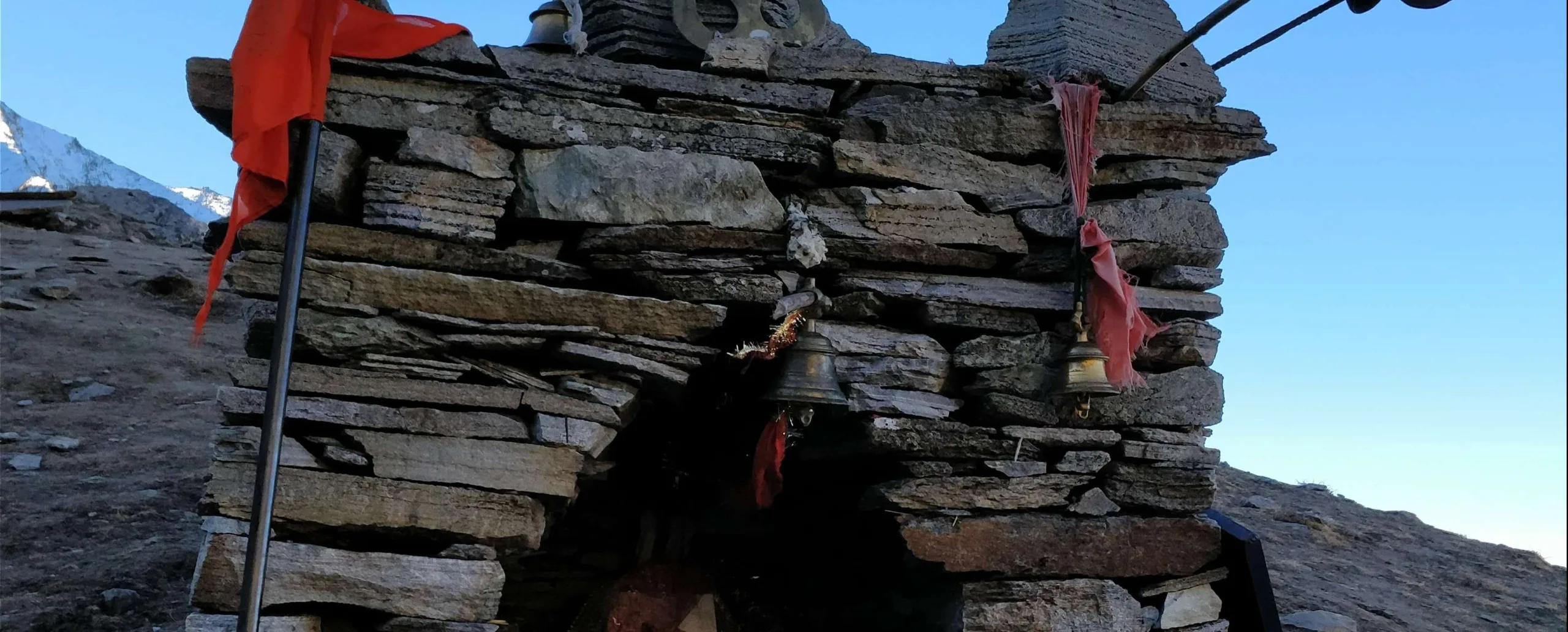
The trail from Pathar Nachauni climbs towards Kalu Vinayak, a small shrine located on the high ridge.
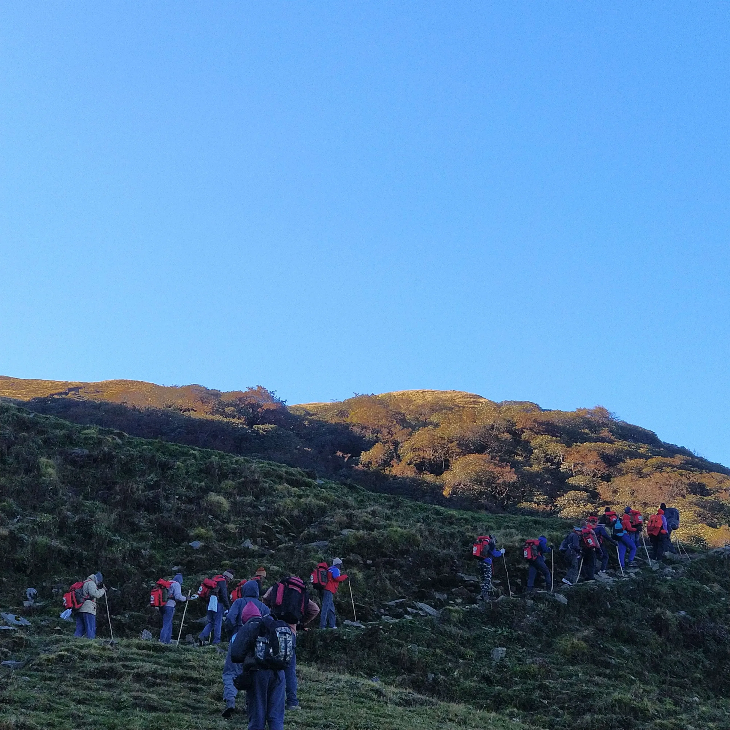
The ascent is a steep zig-zag climb and is one of the physically demanding sections of the trek.
Beyond Kalu Vinayak, the landscape changes dramatically. The green meadows begin to disappear and are replaced by rock, scree and high-altitude terrain.
The trail then descends gradually towards Bagwabasa, the final high-altitude camp before Roopkund. Weather can change rapidly at this altitude.
Terrain: Steep ascent → rocky ridge → descent to Bagwabasa.
Ascent: Steep
Descent: Moderate to Difficult
Maximum altitude on route: Approximately 14,500 ft
Overnight: Bagwabasa High Camp
⭐ The Roopkund Summit Day
| Bagwabasa → Roopkund | 8 km |
| Roopkund → Pathar Nachauni | 4 km |
| Total Trek | Approximately 12 km |
| Duration | 6 hours + 4 hours |
| Maximum Altitude | Approximately 16,500 ft |
| Night Halt | Pathar Nachauni – 12,800 ft |
An early morning start is essential.
The trail from Bagwabasa to Roopkund is the most challenging section of the entire trek.
The route involves steep high-altitude climbing over rocky and potentially snow-covered terrain.
Finally, the trail reaches the legendary Roopkund Lake, situated at approximately 16,500 feet.
Roopkund — The Skeleton Lake
Standing beside the mysterious lake, surrounded by the enormous Himalayan landscape, is the defining moment of the trek.
Participants will spend appropriate time at Roopkund and begin their return to Bhagwabasa Campsite for hot lunch. After lunch, the participants will begin their descent towards Pathar Nachauni.
Terrain: Very steep ascent → rocky/snowy high-altitude terrain → descent
Ascent: Very Steep / Strenuous
Descent: Long and demanding
Difficulty: Extreme physical challenge
This is the toughest day of the program.
Participants must be prepared for a long day at extreme altitude.
Overnight: Pathar Nachauni Camp
| Distance | 15 km |
| Duration | Approximately 7 hours |
| Altitude | 7,700 ft |
The final trekking day begins with a long descent from the high-altitude zone.
The landscape gradually transforms from rocky alpine terrain into lush forests as the altitude decreases.
The group proceeds towards Wan, from where vehicles will take the participants back to Lohajung.
Terrain: Long descent with some undulating sections.
Ascent: Minimal.
Descent: Long and moderately strenuous
Highlight: A spectacular transition from the barren high-altitude landscape back into the green Himalayan forests.
Overnight: Lohajung Base Camp
Check-out after breakfast
Breakfast at the base camp followed by check-out.
Difficult High-Altitude Trek
Roopkund is not recommended for beginners unless they possess a very good level of physical fitness and are capable of undertaking strenuous high-altitude trekking.
Major challenges include: maximum altitude of approximately 16,500 ft, significant altitude gain, steep ascents, long descents, rocky and uneven terrain, possible snow and ice, long trekking days, unpredictable Himalayan weather, reduced oxygen at high altitude.
The most demanding section: Bagwabasa → Roopkund → Pathar Nachauni
The program fee covers the services specified under the YHAI programme inclusions.
YHAI will arrange transportation from Dehradun (Prince Chowk) to Lohajung and the return transfer as applicable. However, transportation charges are payable separately by the participants and are NOT included in the ₹17,500/- programme fee.
Participants who have booked online must cancel their booking through online via website at least 5 days before the reporting date.
Participants who have booked offline must send a cancellation request by email to trekking@yhaindia.org at least 5 days before the reporting date.
Only cancellations made within the above-mentioned timeline will be eligible for a credit shell or refund. Cancellation requests received less than 5 days before the reporting date will not be entertained and will not be eligible for a credit shell or refund.
Participants opting for refund will get 50% refund of the paid program fee. The refund is processed only after completion of the program.
Participants opting for a credit shell will receive 100% of the paid participation fee as credit, valid until 31 December 2027. The credit shell may be used for any program organized by the YHAI National Office or YHAI State Branches/Units that have a credit shell policy in their respective programs for the National Office Programs. The credit shell can only be used in trekking/programs and cannot be adjusted in membership fee or hostel booking.
If the cost of the new program is lower than the available credit, the remaining balance may be used for another eligible trek/program until 31 December 2027. If the cost of the new program is higher than the available credit, the difference must be paid by the participant.
A program booked using a credit shell cannot be cancelled or converted into another credit shell/refund under any circumstances.
A confirmed seat may be transferred to a family member or friend. Once transferred, the seat cannot be transferred again or cancelled.
Note: If any program will be cancelled due to Natural Calamity / Government Restriction / Cancellation of Permission or any other reasons, YHAI will be accountable only for program fees and not other expenses which participants have made for joining the program. In these circumstances the decision for participation fees will be considered by the YHAI and will be bound to all.
From ₹17,500

Quick Links
Information